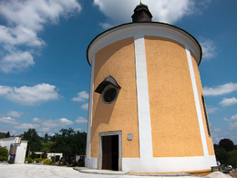
© Schlögener Schlinge (c) WGD Donau Oberösterreich Tourismus GmbH/GoodMorningWorld_MSchillinger
Schlögener Schlinge (c) WGD Donau Oberösterreich Tourismus GmbH/GoodMorningWorld_MSchillinger
search
Search
Close

Perg: Kugelmanderlweg Trail

  • culturally interesting
  • Flatly

 Interactive elevation profile

Download GPS data
Create PDF

Tour-Details

Starting place: 4320 Perg
Destination: 4320 Perg

duration: 3h 0m
length: 9,1 km
Altitude difference (uphill): 176m
Altitude difference (downhill): 176m

Lowest point: 248m
Highest point: 333m
difficulty: easy
condition: easy
panoramic view: Great panorama

Paths covering:
Asphalt, Path / trail, Gravel, Other

powered by TOURDATA | Suggest a change

Short description:
Hainbuchen - Aisthofen - Weinzierl - Zeitling - Perg
Quality of experience: *****

Recommended season:
  • April
  • May
  • June
  • July
  • August
  • September
  • October
Properties:
  • Loop
  • Refreshment stops available
  • Cultural/historical value

Description:
We start at Hauptplatz square and follow Lebinger Straße northwards. At the end of the road we turn into Mühlsteinstraße and follow the road uphill. We take a left turn at the end of the settlement and cross the road. On the other side we meet Donausteig Trail and follow it against the direction of the signposts. Having crossed a forest section we take a right turn into the road. Past two farm houses we get to Aisthofener Brook. We cross ...

 Interactive elevation profile

Download GPS data
Create PDF

Tour-Details

Starting place: 4320 Perg
Destination: 4320 Perg

duration: 3h 0m
length: 9,1 km
Altitude difference (uphill): 176m
Altitude difference (downhill): 176m

Lowest point: 248m
Highest point: 333m
difficulty: easy
condition: easy
panoramic view: Great panorama

Paths covering:
Asphalt, Path / trail, Gravel, Other

powered by TOURDATA | Suggest a change
Protected by