
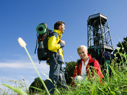
© Schlögener Schlinge (c) WGD Donau Oberösterreich Tourismus GmbH/GoodMorningWorld_MSchillinger
 WGD Donau Oberösterreich Tourismus GmbH/GoodMorningWorld_MSchillinger")
 WGD Donau Oberösterreich Tourismus GmbH/GoodMorningWorld_MSchillinger")
Kirchberg: Donausteig Loop Trail


- Flatly
Interactive elevation profile
Create PDF
Tour-Details
Starting place: 4131 Kirchberg ob der Donau
Destination: 4131 Kirchberg ob der Donau
duration: 5h 45m
length: 16,8 km
Altitude difference (uphill): 336m
Altitude difference (downhill): 337m
Lowest point: 277m
Highest point: 605m
difficulty: medium
condition: medium
panoramic view: Dreamtour
Paths covering:
Asphalt, Path / trail, Gravel, Other
powered by TOURDATA | Suggest a change
Short description:
Kirchberg - Exlau – Partenstein power station - Ebenmühle - Kirchberg
Kirchberg - Exlau – Partenstein power station - Ebenmühle - Kirchberg
Quality of experience: ****
Recommended season:
- April
- May
- June
- July
- August
- September
- October
Properties:
Description:- Loop
- Refreshment stops available
We start in the village centre (at the primary school) and walk westwards. We keep to the left and follow the side road past some farm houses through the cultured landscape. At the last farm the road merges into a gravel road and meanders its way downhill through the forest until we get to Exlau/Donau (rest stop, Viking’s Village). Now we follow the road along the Danube and keep the direction by following the course of Große Mühl River. We ...
Starting point: Kirchberg
Destination: Volksschule Kirchberg
further information:
- Flatly
- Board possible
")


")
")
")
Accessibility / arrival
Bus: www.postbus.at; Schiff: Anlegestelle in Untermühl und UntermühlParking
In the village centre of Kirchberg
Getting there
By car: from Linz on the B127 to Altenfelden, junction towards Kirchberg
By bus: time table information at: http://www.ooevv.at
By train: Mühlkreisbahn train to Neufelden train station -> approx. 10km to Kirchberg
By plane: Linz/Hörsching
Bus: www.postbus.at; Schiff: Anlegestelle in Untermühl und UntermühlParking
In the village centre of Kirchberg
Most economical season
- Spring
- Summer
- Autumn
Please get in touch for more information.
Ortsplatz 5
4131 Kirchberg ob der Donau
Phone +43 7282 4601
E-Mail gemeindeamt@kirchberg-donau.at
Web www.donauregion.at/kirchberg
Web www.donauregion.at
https://www.donauregion.at/kirchberg
http://www.donauregion.at
http://www.donauregion.at
Interactive elevation profile
Create PDF
Tour-Details
Starting place: 4131 Kirchberg ob der Donau
Destination: 4131 Kirchberg ob der Donau
duration: 5h 45m
length: 16,8 km
Altitude difference (uphill): 336m
Altitude difference (downhill): 337m
Lowest point: 277m
Highest point: 605m
difficulty: medium
condition: medium
panoramic view: Dreamtour
Paths covering:
Asphalt, Path / trail, Gravel, Other
powered by TOURDATA | Suggest a change
Kirchberg: Donausteig Loop Trail
Suggest changes
Please let us know how we can improve the quality of this object or if there is any incorrect information on this page (eg. opening hours, contact, etc.).
Please fill in all fields marked *.