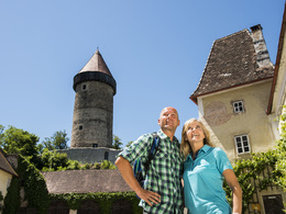
© ©WGDDonauOberoesterreichTourismusGmbHCMVisuals Donauradweg reloaded, Schlögener Schlinge, Donauschlinge, Schlögenerschlinge, Haibach
search
Search
Close

Klam: Klam Loop Trail

  • Flatly

 Interactive elevation profile

Download GPS data
Create PDF

Tour-Details

Starting place: 4352 Klam
Destination: 4352 Klam

duration: 2h 0m
length: 6,0 km
Altitude difference (uphill): 103m
Altitude difference (downhill): 103m

Lowest point: 279m
Highest point: 382m
difficulty: easy
condition: very easy
panoramic view: Some Views

Paths covering:
Asphalt, Gravel, Other

powered by TOURDATA | Suggest a change

Short description:
Loop hike through forests and across meadows.

Recommended season:
  • April
  • May
  • June
  • July
  • August
  • September
  • October
Properties:
  • Loop
  • Refreshment stops available

Description:
We start at the municipal office in Klam, No. 43, 4352 Klam and hike north-eastwards. After some 300m we take a left turn and walk along side roads to Linden. We keep the direction until the road takes a left turn after the last farm house. We take a left turn into the forest at the next crossing and after some 1.5km we pass a farm house and continue on the road southwards. At the next crossing we meet Donausteig Trail and follow it back to Klam.Directions:
Wir ...
Starting point: Klam
Destination: Gemeindeamt Klam

further information:
  • Flatly
  • Board possible

Accessibility / arrival

Getting there
Coming from Linz: on the B3 to Baumgartenberg, take then a left turn towards Klam.

Coming from Vienna: on the A1 autobahn to Ybbs, continue on the B3 to Grein, take a right turn towards Klam

Public Transit
www.postbus.atParking
Public car park opposite of the municipal office
Travelling by public transport
Route planner for independent travellers
Most economical season
  • Spring
  • Summer
  • Autumn

Please get in touch for more information.


Klam: Klam Loop Trail
Marktgemeindeamt Klam
Klam 43
4352 Klam

Phone +43 43 7255
Fax machine +43 7269 72554
E-Mail gemeinde@klam.at
Web www.klam.at
Web www.donauregion.at
https://www.klam.at
http://www.donauregion.at

We speak the following languages

German

 Interactive elevation profile

Download GPS data
Create PDF

Tour-Details

Starting place: 4352 Klam
Destination: 4352 Klam

duration: 2h 0m
length: 6,0 km
Altitude difference (uphill): 103m
Altitude difference (downhill): 103m

Lowest point: 279m
Highest point: 382m
difficulty: easy
condition: very easy
panoramic view: Some Views

Paths covering:
Asphalt, Gravel, Other

powered by TOURDATA | Suggest a change
Protected by