


Gusental cycle path R28


- Suitable for families
Interactive elevation profile
Create PDF
Tour-Details
Path number: R28
Starting place: 4204 Reichenau im Mühlkreis
Destination: 4222 St. Georgen an der Gusen
duration: 2h 48m
length: 34,6 km
Altitude difference (uphill): 653m
Altitude difference (downhill): 151m
Lowest point: 243m
Highest point: 759m
difficulty: medium
condition: medium
panoramic view: Great panorama
Paths covering:
Asphalt
powered by TOURDATA | Suggest a change
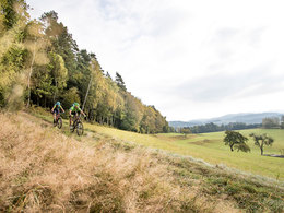
The Gusental Bike Path is a route that takes you from north to south through the Mühlviertel.
The starting point is on the Grenzland Bike Path near Reichenau in the Mühlkreis. Now you let your bike roll towards the south through the landscape characterised by granite. After passing Gallneukirchen and Engerwitzdorf, you are close to your destination. In St Georgen an der Gusen, the Gusental Bike Path finally merges with the Danube Bike Path.
Designation: R28 (Within the network of national bike paths in Upper Austria)
Starting point: Grenzland Bike Path in Reichenau
Destination: Danube Bike Path near St Georgen an der Gusen
further information:
- Board possible
Accessibility / arrival
By car:
Motorway Linz - B 126 - Hellmonsödt - Reichenau
By bus:
Bundesbus from Linz
Most economical season
- Summer
Please get in touch for more information.
")
Freistädter Straße 119
4041 Linz
Phone +43 732 221022
Fax machine +43 732 7277 - 701
E-Mail info@oberoesterreich.at
Web www.oberoesterreich.at/landesradweg…
https://www.oberoesterreich.at/landesradwege
Interactive elevation profile
Create PDF
Tour-Details
Path number: R28
Starting place: 4204 Reichenau im Mühlkreis
Destination: 4222 St. Georgen an der Gusen
duration: 2h 48m
length: 34,6 km
Altitude difference (uphill): 653m
Altitude difference (downhill): 151m
Lowest point: 243m
Highest point: 759m
difficulty: medium
condition: medium
panoramic view: Great panorama
Paths covering:
Asphalt
powered by TOURDATA | Suggest a change
Suggest changes
Please let us know how we can improve the quality of this object or if there is any incorrect information on this page (eg. opening hours, contact, etc.).
Please fill in all fields marked *.