
© Aschach on the Danube © WGD Donau Oberösterreich Tourismus GmbH


Eferdinger Landl Bike Path R18


- Suitable for families
- Flatly
Interactive elevation profile
Create PDF
Tour-Details
Path number: R18
Starting place: 4070 Eferding
Destination: 4070 Eferding
duration: 5h 0m
length: 75,8 km
Altitude difference (uphill): 263m
Altitude difference (downhill): 259m
Lowest point: 255m
Highest point: 422m
difficulty: medium
condition: medium
panoramic view: Great panorama
Paths covering:
Asphalt
powered by TOURDATA | Suggest a change
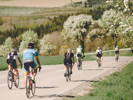
The Eferdinger Landl Bike Path entices you away from the Danube and into the landscape in and around the Eferdinger Becken.
Designation: R18 (Within the network of national bike paths in Upper Austria)
Starting point: Donauweg in Brandstatt
Destination: Donauweg in Brandstatt
further information:
- Flatly
- Board possible
Accessibility / arrival
The starting point is north of Eferding in Brandstatt, directly on the Danube at Gasthof Dieplinger.
By car:
West motorway (A1) Salzburg - exit Sattledt - Wels - Eferding
By rail:
Coming from Linz, take the Linzer Lokalbahn to Eferding.
Coming from Wels, take the Bundesbahn to Eferding.
Most economical season
- Spring
- Summer
- Autumn
Please get in touch for more information.
Freistädter Straße 119
4041 Linz
Phone +43 732 221022
Fax machine +43 732 7277 - 701
E-Mail info@oberoesterreich.at
Web www.oberoesterreich.at/landesradweg…
https://www.oberoesterreich.at/landesradwege
Interactive elevation profile
Create PDF
Tour-Details
Path number: R18
Starting place: 4070 Eferding
Destination: 4070 Eferding
duration: 5h 0m
length: 75,8 km
Altitude difference (uphill): 263m
Altitude difference (downhill): 259m
Lowest point: 255m
Highest point: 422m
difficulty: medium
condition: medium
panoramic view: Great panorama
Paths covering:
Asphalt
powered by TOURDATA | Suggest a change
Eferdinger Landl Bike Path R18
Suggest changes
Please let us know how we can improve the quality of this object or if there is any incorrect information on this page (eg. opening hours, contact, etc.).
Please fill in all fields marked *.