
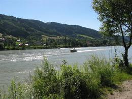
© Schlögener Schlinge (c) WGD Donau Oberösterreich Tourismus GmbH/GoodMorningWorld_MSchillinger
 WGD Donau Oberösterreich Tourismus GmbH/GoodMorningWorld_MSchillinger")
 WGD Donau Oberösterreich Tourismus GmbH/GoodMorningWorld_MSchillinger")
Travel Ideas
Seenradrundweg


- pets allowed
- All weather
- Suitable for families
- Suitable for kids (all ages)
- Flatly
- Possible accommodation
Interactive elevation profile
Create PDF
Tour-Details
Starting place: 4143 Neustift im Mühlkreis
Destination: 4143 Neustift im Mühlkreis
duration: 4h 16m
length: 36,1 km
Altitude difference (uphill): 982m
Altitude difference (downhill): 987m
Lowest point: 298m
Highest point: 706m
difficulty: medium
condition: medium
panoramic view: Great panorama
Paths covering:
Asphalt
powered by TOURDATA | Suggest a change
Lake cycle path
Recommended season: from April to October, with great views0.0 km Gasthof Luger (e-bike charging station) : Our cycle tour starts from here. This first takes you 1.5 km along the Danube cycle path to the Rannamühle. Now it's 2 km up the mountain by 300 metres, where you reach Dorf.
3.5 km Dorf : After about 400 m, turn left towards Pühret (the parish church is well worth a visit) and continue along the goods road to Groß- and Kleinmollsberg as far as Haitzendorf (a detour to Donaublick Penzenstein is possible just before Großmollsberg).
10 km Haitzendorf ...
further information:
- Flatly
- Possible accommodation
- Board possible
details mountainbike
- Riding technique: medium
- All weather
- Suitable for groups
- Suitable for schools
- Suitable for kids (all ages)
- Pets allowed
- Suitable for single travelers
- Suitable for families
- Suitable for friends
- Suitable for couples
- Spring
- Summer
- Autumn
Please get in touch for more information.
4143 Neustift im Mühlkreis
Phone +43 7284 8155
mobile +43 664 1119382
E-Mail info@urlaub-neustift.at
Web www.urlaub-neustift.at
http://www.urlaub-neustift.at
You can also visit us on
Visit us on Facebook")
")
")
")
")
")
")
Interactive elevation profile
Create PDF
Tour-Details
Starting place: 4143 Neustift im Mühlkreis
Destination: 4143 Neustift im Mühlkreis
duration: 4h 16m
length: 36,1 km
Altitude difference (uphill): 982m
Altitude difference (downhill): 987m
Lowest point: 298m
Highest point: 706m
difficulty: medium
condition: medium
panoramic view: Great panorama
Paths covering:
Asphalt
powered by TOURDATA | Suggest a change
Seenradrundweg
Suggest changes
Please let us know how we can improve the quality of this object or if there is any incorrect information on this page (eg. opening hours, contact, etc.).
Please fill in all fields marked *.